
Which Charlotte Greenways Actually Connect? A Practical Guide for Walking and Biking |
Where the city’s most useful trails go, what you can actually reach from them and where the network still has gaps. |
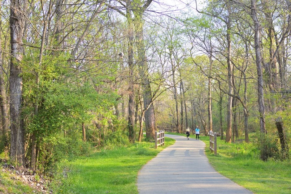
Charlotte’s greenway network looks simple on a map until you try to use it like transportation.
A trail that appears nearby may not actually connect to the next one, a road crossing can turn an easy ride into a stressful one, and some of the city’s best stretches are more useful for getting somewhere than people realize.
That is why the most useful question is not simply “Where are Charlotte’s greenways?”
It is: Which ones actually connect, and what can you realistically reach from them?
Recent conversations among local cyclists and walkers point to a few clear answers.
Start with Little Sugar Creek Greenway
If you want the most practical introduction to Charlotte’s greenway system, Little Sugar Creek is still the obvious place to start.
Locals regularly describe it as the city’s most useful long-distance greenway because it ties together major stretches of south Charlotte, Midtown and areas farther north.
It is the route people mention when they talk about being able to ride for miles without constantly jumping back into traffic.
Depending on where you enter, you can use the corridor for a recreational walk, a longer bike ride, a trip toward Freedom Park or Midtown, or a route that eventually carries you much farther south.
For people who are new to the system, Little Sugar Creek also makes it easier to understand how Charlotte’s greenways function as more than isolated park trails.
It is one of the clearest examples of a greenway acting like a transportation spine.
The McAlpine, McMullen and Four Mile network is more useful than it looks
South Charlotte has another strong cluster that tends to get less attention.
The McAlpine, Lower McAlpine, McMullen Creek and Four Mile Creek greenways create a network that local riders use to reach Ballantyne, Pineville and shopping areas around Rea Road, Johnston Road and Pineville-Matthews Road.
Recent users describe biking from the greenway to places such as The Bowl at Ballantyne, Carmel Commons, Torringdon and shopping near Rea Road.
That is an important distinction.
A greenway becomes much more useful when it gets you near groceries, coffee, restaurants, libraries, parks or workplaces instead of simply giving you an out-and-back trail.
One Charlotte rider credited a newly opened McAlpine/Four Mile connection with making it possible to bike commute several times a week.
That is the difference between a recreational trail and infrastructure people can build part of their routine around.
Where the network still breaks
Charlotte’s greenways are getting more connected, but they are not one continuous protected system yet.
Local cyclists still describe stretches where they have to use sidewalks, neighborhood streets or uncomfortable road crossings to move between major trail systems.
The connection between McAlpine-area greenways and other south Charlotte routes is one example where riders still trade tips for avoiding faster roads.
That is also why blindly following a bike route in a navigation app can be frustrating.
A route may technically work while still putting you on a road that feels unpleasant or unsafe for a casual rider.
Before trying a new connection, it is worth checking the county’s trail map and then looking closely at the street-level sections between greenways.
One major gap is actively being filled
Mecklenburg County is currently building the Sugar Creek Greenway segment from Yorkmont Road toward McDowell Farms.
Construction began in May 2025, and the county currently anticipates completion in mid-2027.
The project matters because every new connection increases the number of trips people can make without leaving the greenway network for long stretches.
It also moves Charlotte closer to the larger vision behind the Cross Charlotte Trail, which is intended to create a long north-south walking and biking corridor through the city.
Best greenways if you want scenery instead of errands
Not every greenway needs to get you to a grocery store.
For a quieter walk or ride, McAlpine Creek remains one of the more frequently recommended options because of its wooded sections, creek views and more natural feel.
Four Mile Creek also works well for people in south Charlotte and can be combined with nearby segments for a longer outing.
The Little Sugar Creek stretch near Freedom Park and Midtown offers a different experience, mixing urban scenery, parks and easy access to nearby businesses.
That makes it a good choice when you want the walk itself to be part of a larger afternoon rather than the entire destination.
Which map should you actually use?
The best starting point is Mecklenburg County’s official greenway map because it shows the county’s current trail network and individual greenway systems.
Carolina Thread Trail resources can also help when a route extends beyond one county or connects into the broader regional trail system.
For cycling, locals also mention Ride with GPS and Strava because both can show routes other riders actually use.
Google Maps is useful for orientation, but local cyclists repeatedly caution that its bike directions can send riders onto roads they would not choose themselves.
The best route-planning strategy is to use the official trail map first, then use a routing app to study the gaps.
The bigger story is that Charlotte’s greenways are becoming places you can actually use
For years, Charlotte’s greenways were often treated primarily as recreational amenities.
That is changing as individual sections connect into larger networks.
The more those links come together, the more realistic it becomes to walk to coffee, bike to work, reach a park, run an errand or spend an afternoon moving through Charlotte without sitting in a car.
There are still frustrating gaps, and some crossings remain better suited to confident cyclists than casual riders.
But if you have not looked at Charlotte’s greenway system recently, it is worth looking again.
The trail near your neighborhood may connect to a lot more than you think. |
Sources & further reading
Mecklenburg County Parks and Recreation: Greenways
Mecklenburg County project page: Sugar Creek Greenway, Yorkmont to McDowell Farms
Carolina Thread Trail regional map |

Oct 14, 2026
Inside Upcycle Arts, Charlotte’s Creative Reuse Shop
Why Charlotte crafters keep recommending this Eastway shop for affordable donated art supplies and unexpected finds.

Oct 3, 2026
Halloween Events in Charlotte 2026: Trick-or-Treating, Haunted Attractions & Family Fun
A growing guide to Charlotte-area Halloween events, candy crawls, pumpkin patches, haunted trails and family fun throughout October.

Sep 30, 2026
That's Novel Books: A Charlotte Used Bookstore Where Readers Gather
From Silent Book Club nights to a Sunday read-a-thon at Camp North End
Sep 23, 2026
Frank's Beer Shop: The Dog-Friendly Bar Built on a Rescue
Frank's Beer Shop in East Charlotte is named for a rescue dog and built on community, weekly dog walks and shelter adoptions. Meet the local hero behind it.
0 Comments
Join the conversation
Be the first to comment
Share your thoughts above.